

Programming languages: R, R Shiny, Python, MATLAB, Git
Remote sensing/GIS: Google Earth Engine (JS and Python APIs), GDAL, QGIS, ArcGIS, Agisoft Metashape, ENVI
R packages: sf, sp, raster, dplyr, purrr, shiny, leaflet, mapboxapi, plotly, caret, random forest, xgboost, ggplot, gganimate
Python packages: scikit-learn, matplotlib, numpy, pandas, scipy, geemap
Web development: R Shiny, Google Earth Engine Apps, HTML, CSS, Bootstrap
Video/image editing: Shotcut, OBS Studio, Final Cut Pro
An assortment of projects and products that I've produced over the years. Click to dive deeper.
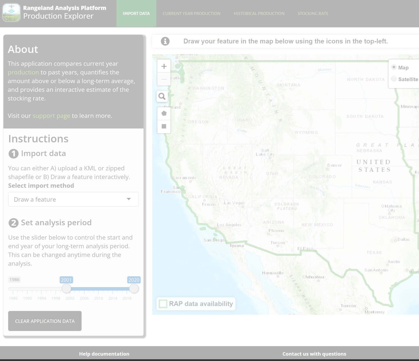
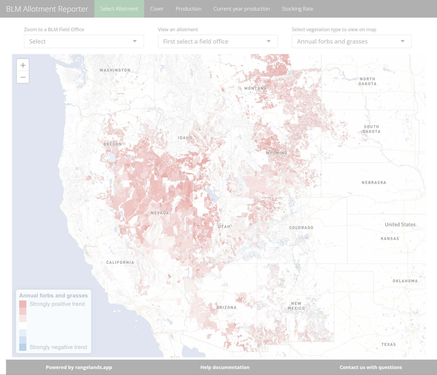
Web Application
Web Application
Training Resources

Training Resources

Data Visualization
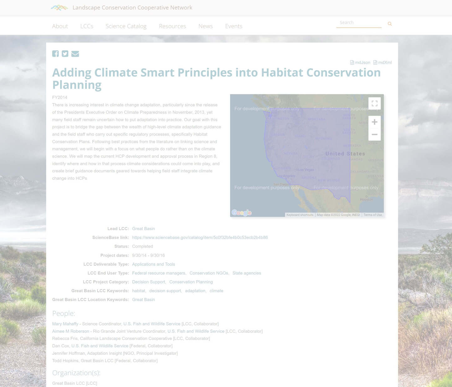
Remote Sensing Project
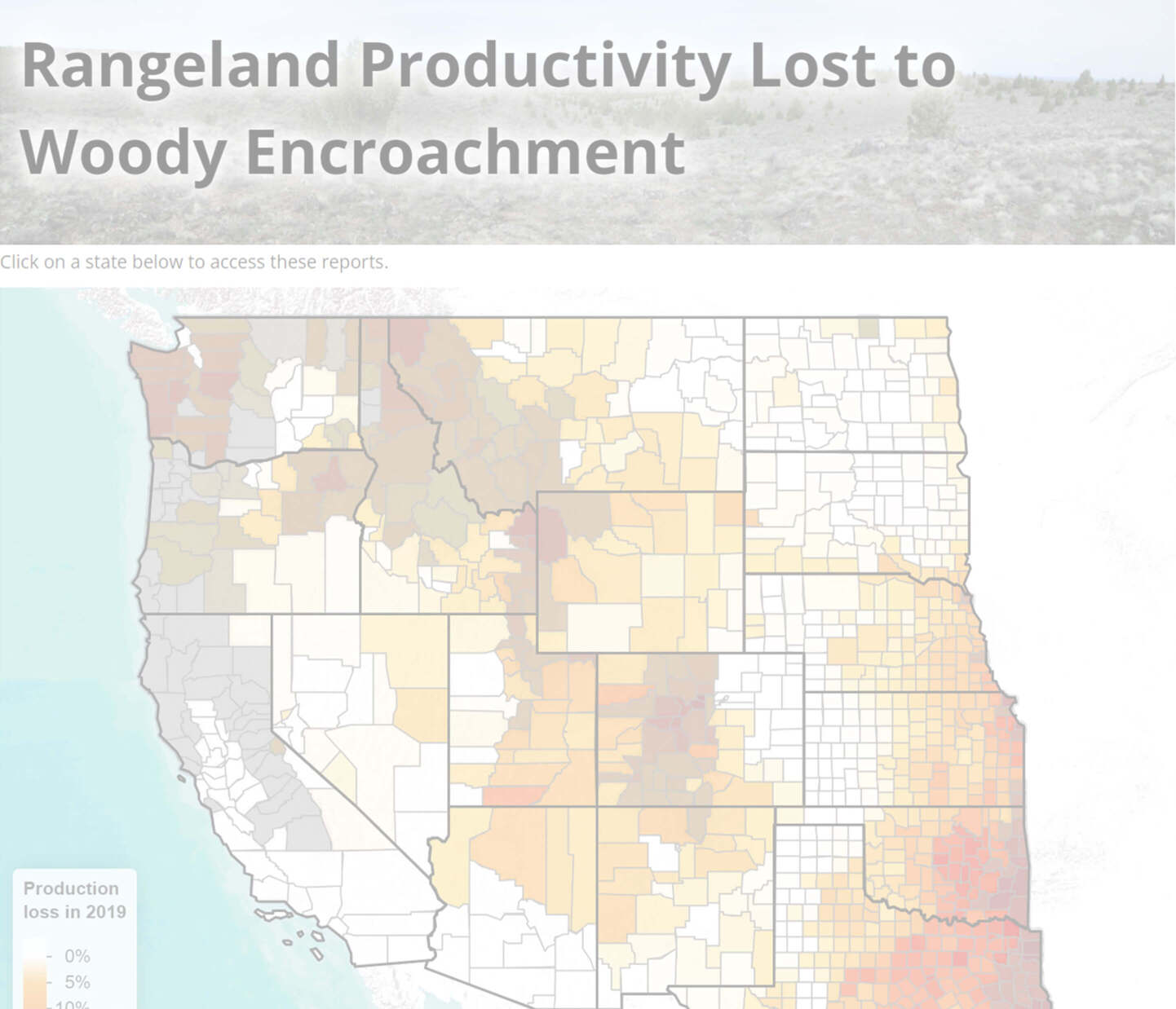
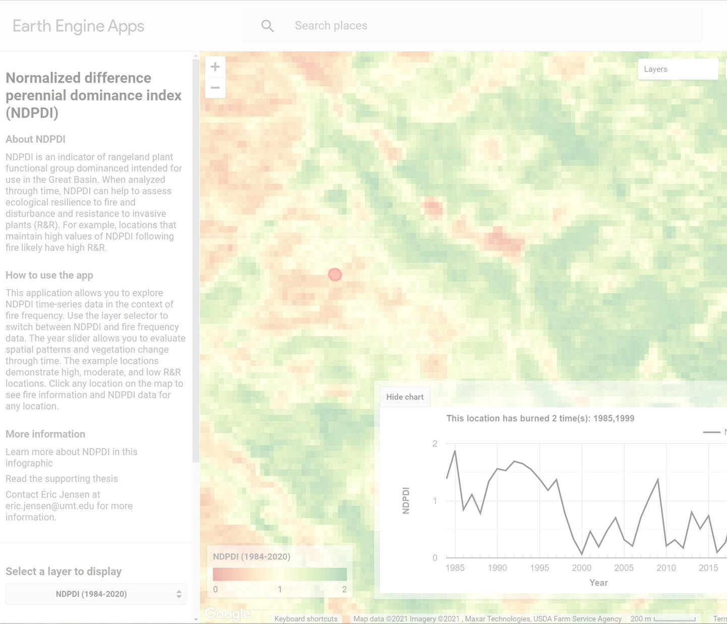
Web Application

Remote Sensing Project
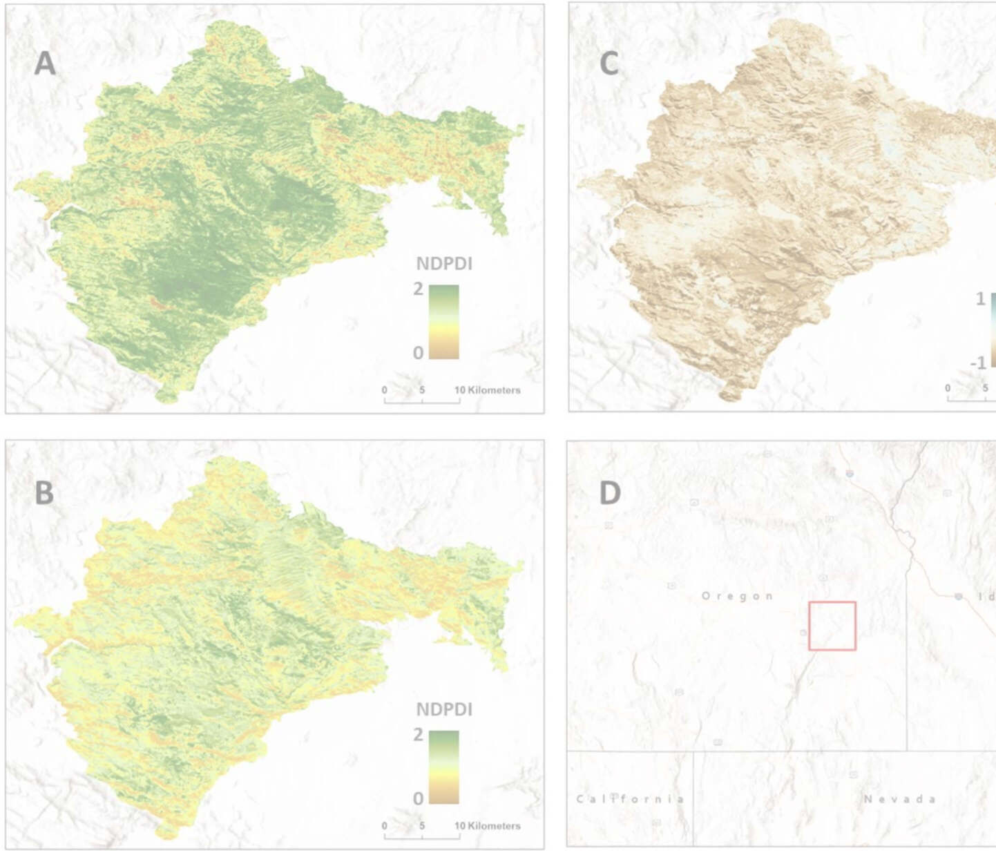
Remote Sensing Project
Web Application

Web Application
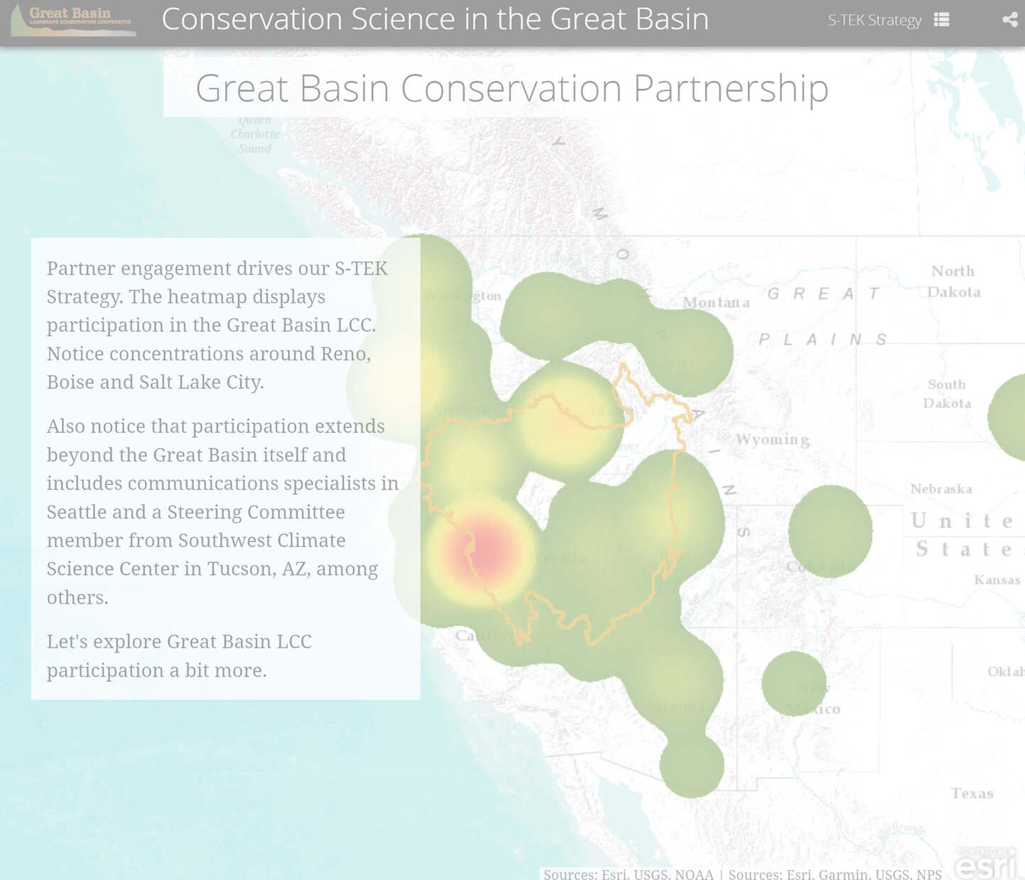
Story Map
Web Database
Presentations


Social Media